GATE Geomatics Engineering Syllabus 2027: Complete GE Syllabus and Topics
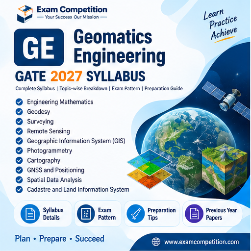
GATE Geomatics Engineering Syllabus 2027
The GATE 2027 Geomatics Engineering (GE) syllabus covers the fundamental concepts and techniques used in surveying, mapping, remote sensing, geographical information systems, global navigation satellite systems, photogrammetry and digital image processing. The official syllabus released by IIT Madras is divided into a common section and two subject sections: Part B1: Surveying and Mapping and Part B2: Image Processing and Analysis.
Candidates preparing for the GE paper should study the topics systematically because the syllabus combines mathematical and statistical concepts with practical geomatics technologies and image-analysis techniques.
GATE 2027 GE Syllabus at a Glance
| Section | Major Areas |
|---|---|
| Part A: Common Section | Engineering Mathematics, Remote Sensing, GNSS and GIS |
| Part B1: Surveying and Mapping | Maps, Land Surveying and Aerial Photogrammetry |
| Part B2: Image Processing and Analysis | Data Quantization and Processing, Digital Image Processing, Corrections, Enhancement, Transformation, Classification and Segmentation |
Part A: Common Section
Part A contains common geomatics topics covering mathematical and statistical methods, remote sensing, GNSS and GIS.
1. Engineering Mathematics
The Engineering Mathematics portion includes the following topics:
| Topic | Syllabus Areas |
|---|---|
| Surveying Measurements | Fundamental concepts related to surveying measurements |
| Accuracy and Precision | Accuracy, precision and measurement quality |
| Most Probable Value | Determination and application of most probable values |
| Errors and Adjustments | Errors in measurements and their adjustments |
| Regression Analysis | Regression analysis |
| Correlation | Correlation coefficient |
| Least Squares | Least squares adjustment |
| Statistical Significance | Statistical significant value |
| Chi-Square Test | Chi-square test |
2. Remote Sensing
Remote Sensing is an important component of the GE syllabus. Candidates should understand both the physical principles behind remote sensing and the characteristics and interpretation of remotely sensed data.
| Topic | Detailed Syllabus |
|---|---|
| Basic Concepts | Basic concept of Remote Sensing |
| Physical Principles | Physical Principles of Remote Sensing |
| Spectral Signature | Spectral signature |
| Resolution | Spectral, spatial, temporal and radiometric resolutions |
| Platforms and Sensors | Platforms and sensors |
| Remote Sensing Data Products | PAN, multispectral, microwave, thermal and hyperspectral data |
| Data Interpretation | Visual and digital interpretation methods |
3. GNSS
The GNSS section focuses on the principles, components, data collection methods and error correction techniques associated with Global Navigation Satellite Systems.
| Topic | Syllabus Areas |
|---|---|
| GNSS Principles | Principle used in GNSS |
| Components | Components of GNSS |
| Data Collection | GNSS data collection methods |
| DGPS | Differential Global Positioning System |
| Errors and Corrections | Errors in observations and corrections |
4. GIS
The GIS section covers the fundamentals of geographic information systems, spatial and non-spatial databases, data models and important spatial-analysis operations.
| Topic | Detailed Syllabus |
|---|---|
| Introduction | Introduction to GIS |
| Data Sources | GIS data sources |
| Data Models | Data models and data structures |
| DBMS | Database Management Systems |
| Database Creation | Creation of spatial and non-spatial databases |
| Spatial Analysis | Interpolation, buffer, overlay, terrain modeling and network analysis |
Part B1: Surveying and Mapping
Part B1 covers surveying and mapping fundamentals, including map characteristics, coordinate systems, projections, surveying instruments, measurement techniques and aerial photogrammetry.
1. Maps
| Topic | Syllabus Areas |
|---|---|
| Maps and Engineering Projects | Importance of maps to engineering projects |
| Types of Maps | Types of maps and their uses |
| Scales | Map scales and uses |
| Plotting Accuracy | Plotting accuracy |
| Map Sheet Numbering | Map sheet numbering |
| Coordinate Systems | Cartesian and geographical coordinate systems |
| Map Projections | Map projections |
| Map Datum | MSL, geoid, spheroid and WGS-84 |
2. Land Surveying
Land Surveying includes conventional and modern surveying instruments and methods used for measurement, levelling, traversing and geometric positioning.
| Topic | Detailed Syllabus |
|---|---|
| Levelling | Levelling instruments and levelling methods |
| Compass | Compass |
| Theodolite | Theodolite |
| Total Station | Total Station and COGO functions |
| Tachometer | Tachometer |
| Trigonometric Levelling | Trigonometric levelling |
| Traversing | Traversing |
| Triangulation | Triangulation |
| Trilateration | Trilateration |
3. Aerial Photogrammetry
Aerial Photogrammetry covers the basic principles and measurements associated with aerial photographs and elevation extraction.
| Topic | Syllabus Areas |
|---|---|
| Photographs | Types of photographs |
| Flying Height and Scale | Flying height and scale |
| Relief Displacement | Relief or height displacement |
| Stereoscopy | Stereoscopy |
| Parallax | Height determination using Parallax Bar |
| DEM | Digital Elevation Model |
Part B2: Image Processing and Analysis
Part B2 focuses on digital image fundamentals, image processing, radiometric and geometric corrections, enhancement, transformation, classification and segmentation.
1. Data Quantization and Processing
| Topic | Syllabus Areas |
|---|---|
| Sampling and Quantization | Sampling and quantization theory |
| Linear System | Principle of Linear System |
| Convolution | Convolution |
2. Digital Image Processing
Candidates should understand digital image characteristics and the statistical measures used to analyse image data.
| Topic | Detailed Syllabus |
|---|---|
| Image Characteristics | Digital image characteristics |
| Histogram | Image histogram and its significance |
| Scattergram | Scattergram and its significance |
| Variance-Covariance | Variance-Covariance matrix and its significance |
| Correlation Matrix | Correlation matrix and its significance |
3. Basic Radiometric and Geometric Corrections
This portion includes the basic correction procedures required for processing and aligning digital images.
- Registration
- Resampling techniques
- Basic radiometric corrections
- Basic geometric corrections
4. Image Enhancement
| Area | Syllabus Topics |
|---|---|
| Spatial Enhancement | Noise and spatial filters |
| Contrast Enhancement | Linear and non-linear methods |
5. Image Transformation
The Image Transformation section includes statistical, colour and spectral-index based transformations.
| Topic | Detailed Syllabus |
|---|---|
| Principal Component Analysis | Principal Component Analysis (PCA) |
| Discriminant Analysis | Discriminant Analysis |
| Colour Transformations | RGB-IHS and CMYK transformations |
| Indices | Ratios, NDVI and NDWI |
6. Basic Image Classification and Segmentation
| Topic | Syllabus Areas |
|---|---|
| Classification | Basic image classification |
| Supervised Techniques | Supervised techniques |
| Unsupervised Techniques | Unsupervised techniques |
| Segmentation | Basic image segmentation |
| Accuracy Analysis | Accuracy analysis |
GATE 2027 GE Preparation Strategy
GE preparation should combine conceptual study with numerical and application-based practice. Start with measurement errors, accuracy, adjustment methods and statistical concepts before moving into remote sensing, GNSS and GIS.
For Surveying and Mapping, focus on instruments, measurement methods, coordinate systems, map projections, datums, traversing, triangulation, trilateration and photogrammetry. For Image Processing and Analysis, pay particular attention to image statistics, corrections, enhancement, transformations, indices, classification and accuracy analysis.
| Preparation Area | What to Focus On |
|---|---|
| Mathematics and Statistics | Errors, adjustments, regression, correlation, least squares and chi-square test |
| Remote Sensing | Spectral signatures, resolutions, sensors, platforms and data interpretation |
| GNSS | Principles, components, data collection, DGPS and error correction |
| GIS | Data models, databases and spatial analysis |
| Surveying | Levelling, instruments, traversing, triangulation and trilateration |
| Photogrammetry | Photographs, scale, stereoscopy, parallax and DEM |
| Image Processing | Sampling, quantization, convolution, corrections and image statistics |
| Image Analysis | Enhancement, PCA, colour transformations, NDVI, NDWI, classification and segmentation |
GATE 2027 GE Syllabus PDF
Candidates should use the official IIT Madras syllabus as the primary reference while preparing for the Geomatics Engineering paper. The official PDF contains the syllabus topics prescribed for GATE 2027.
Download GATE 2027 GE Syllabus PDF
Frequently Asked Questions
What is the GATE 2027 GE paper?
What are the main sections in the GATE GE syllabus?
Does the GE syllabus include GIS and Remote Sensing?
Does GATE GE include Surveying?
Is image processing included in GATE GE?
Source: IIT Madras